The mission
Wild hog surveillance across large Texas properties is currently a human with a truck and a spotlight. The platform flies pre-programmed search patterns, captures thermal imagery, runs classification on the aircraft, and sends real-time notifications — tracking movement patterns across flights instead of hoping to catch animals in the open.
What’s flight-proven
- Autonomous GPS waypoint navigation with 45+ minute endurance
- 2-mile range flight tested; ~60 km theoretical on the CUAV P8 telemetry link
- Long-range digital video via WFB-NG
- ROS offboard control from the companion computer
- Night operations with LED lighting
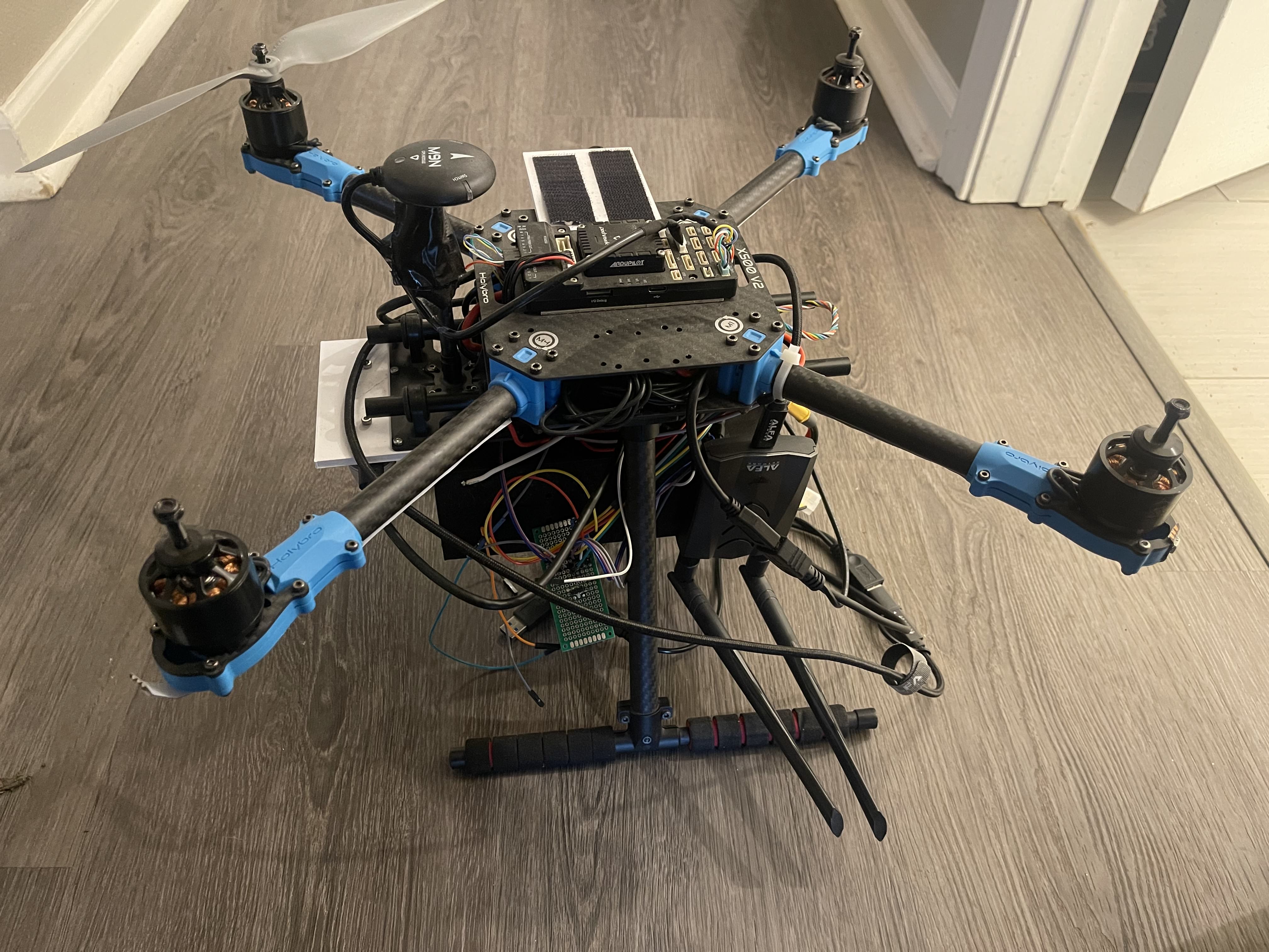
The airframe is a HolyBro X500 pushed to 10-inch arms with 12-inch props, Pixhawk 6x on PX4, with a Raspberry Pi 4 companion computer and a Jetson Orin Nano for inference. The FLIR Boson rides a 3D-printed mount (a proper gimbal is on the roadmap).
In development
Phase II work: precision landing (RealSense D435i + QR fiducials — depth-vs-FC altitude validation flights ran May 2026), integrating the thermal classifier, offboard-control guardrails, and the ground station build-out. Known gremlins being engineered out: ground loops on PDB-powered peripherals, and the Pi’s single Ethernet port being contested between the flight controller and the Jetson.
Further out
Swarm operations over a self-assembling multi-hop relay network (“Drone Area Network”), heavy-lift experiments, and a drone-swarm magnetotellurics moonshot — a distributed antenna array as a low-cost alternative to helicopter-towed geophysics rigs.